U.S. Drought Monitor – Update
Drought Summary Report - Maps Released December 11, 2025
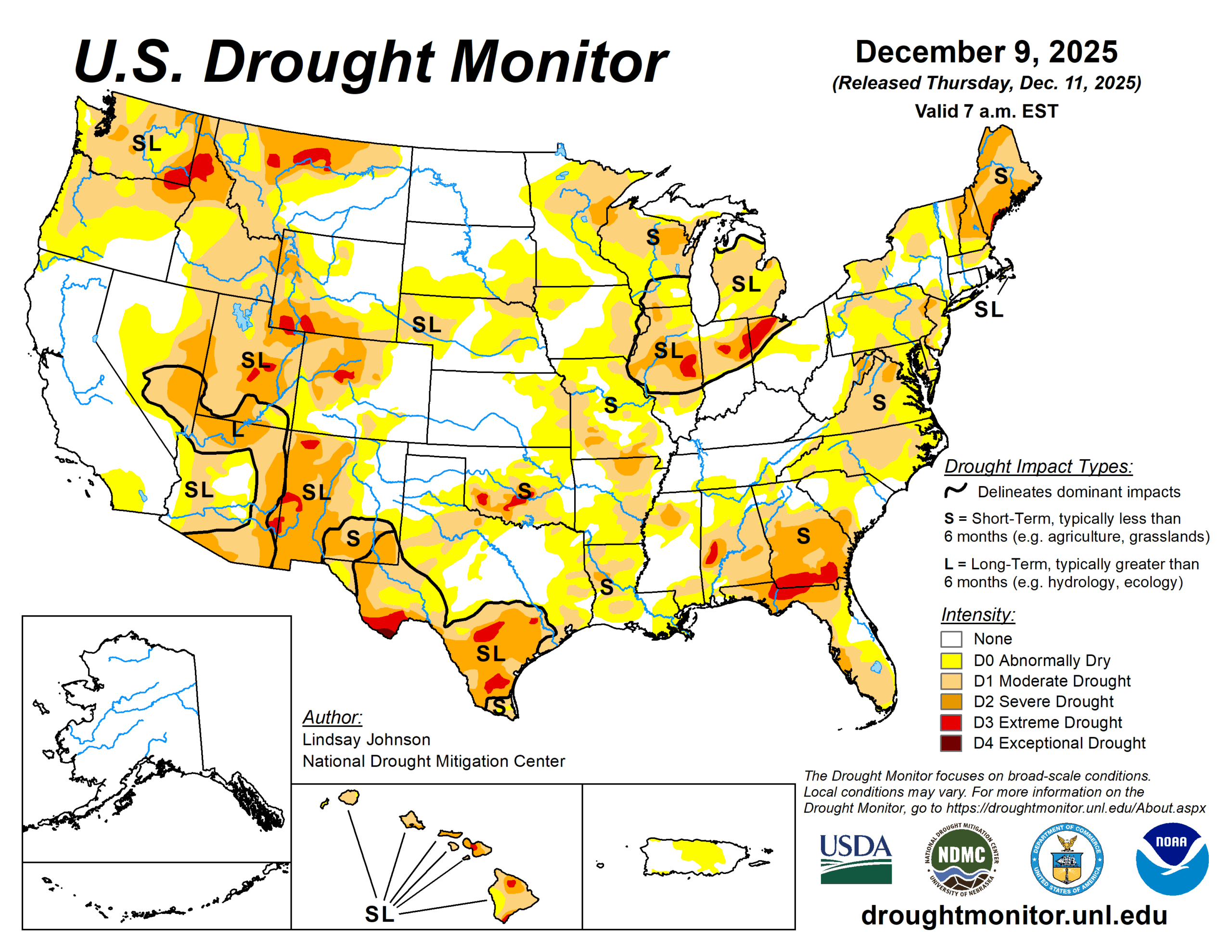
This U.S. Drought Monitor week saw both improvements and degradations across the country, shaped largely by uneven precipitation and widespread colder-than-normal temperatures. Much of the nation was colder than normal, with the sharpest departures in the Midwest and Northeast, where most of the week’s moisture fell as snow and offered limited short-term help for soils and streams. In the West, storm systems delivered substantial rain and mountain snow to the Pacific Northwest and northern Rockies, improving conditions in parts of Washington, northwest Oregon, western Montana and eastern Idaho. However, areas that missed the heaviest precipitation—especially central and southern Oregon, central Idaho and southwestern Montana—saw drought expand as snowpack remained well below normal.
Source: US Drought Monitor
To view the full report visit:
Drought Monitor Report